
An Enchanting Tour of South Peru - Part 2

Inca Trail Route Map
Introduction
The Inca Trail between the Sacred Valley of the Urubamba and the mysterious abandoned Machu Picchu is but one small portion of an incredible network of such trails, which cross stony mountains, bleak deserts, raging rivers, linking the whole of Inca Empire together with its capital at Cusco.
At its peak, the Empire was known to rule from southern Columbia in the north to central Chile in the south, a distance of over 4,500km. To rule such a vast domain, the Incas developed a remarkable communication road system of over 30,000km of trails. Along these trails were rest houses and runners carrying messages like the Pony Express mail of the old American West. In this way the Inca Emperor in the capital city of Cusco could receive news from far away Quito or fresh supply of fish from the Pacific Ocean in just a single day.
The most famous section of the trail is about 45km in length, from the starting point at km 82 to the sacred ruins of Machu Picchu. The scenery is only one of the elements responsible for the magic of the Inca Trail. This Trail combines natural beauty, history and mystery with various ruins along the way.
It is most remarkable to note that many segments of the whole of Inca Trail still remain serviceable after more than half a millennium of neglect. This is an astounding testimony to its construction.
DAY 1 - 22nd April 06 (Km 82 to Wayllabamba)
We began our journey by road from our hotel in Cusco early in the morning. We traveled in a mini-bus and were accompanied by our Guide, Wilber to km 82 (distance by train from Cusco) where we would meet up with our porters.
The first part of our journey to km 82 was pleasant and scenic through mountains and valleys. However, the paved mountainous road soon ended at Ollantaytambo where we had a brief stop to do our last minute shopping. From thereon we turned into a two-way but single-lane dirt track beside the railroad and the Urubamba River.
 |
|
| Scenic journey to km 82 |
Stuck on a single-lane track |
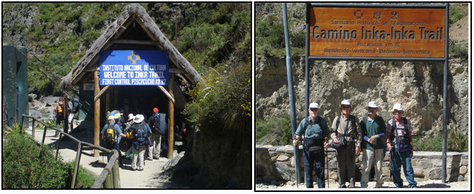
On arrival at km 82, we handed over our excess trekking luggage to our porters leaving us with a light backpack each.
We went through the checkpoint and began our trek at 10.45am.

We started the trek by crossing the Urubamba River and followed the well-maintained and unpaved trail along the Urubamba gorge. It was an easy beginning with beautiful scenery along the way and by 12.45pm we reached a village ahead of our porters and waited for our lunch.
 |
|
View of valley & snow-capped mountain |
Lunch served in a tent
|
The meals were served in a tent. Though they were normally good and plentiful, we could not enjoy eating because the food was laid on a floor mat and we had to sit on small low stools. It would be great if a small dining table and chairs with backrests were to be provided.
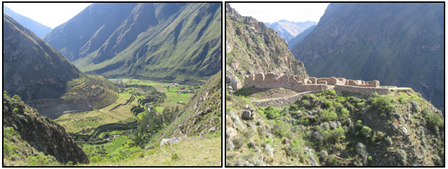
We continued our trek after lunch. After an hour or so we had the first view of two Inca ruins, Llactapata in the valley and Pulpituyuq beside the trail. The former was an agricultural station and the settlement comprised over one hundred buildings for workers and soldiers. The latter was just a fort overlooking the agricultural station.
 |
|
Llactapata ruins
|
Pulpituyuq ruins
|
From Llactapata, the trail turned south, away from the Urubamba valley. It was past 5.00pm when we arrived at a small village of Wayllabamba (3,000m) where we camped for the night. Today we trekked about 12km.
 |
|
Easy first day trek
|
Camping in Llactapata
|