
 |
A TREACHEROUS TREK TO BASE CAMP OF MOUNT ACONCAGUA My fellow trekkers and I have identified Mt. Acongcagua, 6,960 meters above sea level, the highest mountain in the world outside Asia, as one trekking destination we plan to set foot on after we have successfully scaled Mt. Kilimanjaro in Tanzania, Anapurna Circuit in Nepal and the North Face of Mt. Everest in Tibet. But to go to Argentina, we have to travel half way round the globe. The most direct route to Buenos Aries is by MAS with transits in Johannesburg and Cape Town. Still the journey takes well over 24 hours and the airfare costs a bomb. Read below for more details. |
A) Introduction
 My fellow trekkers and I have identified Mt. Acongcagua, 6,960 meters above sea level, the highest mountain in the world outside Asia, as one trekking destination we plan to set foot on after we have successfully scaled Mt. Kilimanjaro in Tanzania, Anapurna Circuit in Nepal and the North Face of Mt. Everest in Tibet. But to go to Argentina, we have to travel half way round the globe. The most direct route to Buenos Aries is by MAS with transits in Johannesburg and Cape Town. Still the journey takes well over 24 hours and the airfare costs a bomb.
As none of my fellow trekkers from Malaysia have ever set foot in Argentina, we have no clue as to the actual local trekking conditions except for the limited information gathered from the Net and other publications. So, we considered it advisable to do an exploratory or reconnaissance survey of the area to find out more about trekking to Mt. Acongcagua.
Amongst the members of our trekking group, only Kenny Lim and I from Malaysia and Larry Logue from America decided to embark on this journey to Argentina. Besides trekking to the Base Camp of Mt. Acongcagua, we decided also to tour Patagonia and Tierra del Fuego. Kenny and I departed on 7/10/03 and returned on 24/10/03. We met Larry in Buenos Aries on 8/10/03.
B) Choice of route to the base camp
Mt. Acongcagua is in the Acongcagua Provincial Park located 180km west of the city of Mendoza. There are two trekking routes to Mt. Acongcagua. These are the Horcones River Route and the Vacas River or Polish Glacier's Route. Their respective base camps are located at Plaza de Mulas (4,300m) and Plaza Argentina (4,200m).
The Horcones Route is the more popular one and its base camp, Plaza de Mulas, is about 40km from Los Horcones, which is 4km from Puente del Inca.
The Vacas River Route is longer but more scenic. Its base camp, Plaza Argentina, is 76km from Punta de Vacas, which is 15km southeast of Puente del Inca. This route is reported to be more technical i.e. it requires the use of ropes, crampons and ice axes.
As we are non-technical climbers, we chose the Horcones Route. I had earlier negotiated with two trekking companies in Mendoza and subsequently appointed INKA Expediciones to organize our trek to Plaza de Mulas.
The trekking season starts only in mid November and therefore we were not able to use the services of mules to transport our food, cooking utensils, tents and sleeping bags etc to the base camp. This is because mules, even though sure-footed in the mountains, cannot manoeuver safely in snow and ice. Instead we had to engage three porters at US$60 each per day, expensive by any standards.

C) Trekking Itinerary
| 08/10/03 | Arrived in Buenos Aries | |
| 09/10/03 | In Buenos Aries | |
| 10/10/03 |
Flew from Buenos Aries to Mendoza (11/2 hr flight). Met our guide, Andres at the airport and transferred to INKA's office. Drove from Mendoza to Los Penitentes, (165km and 3 hr drive from Mendoza along RN7 Highway) and overnight in Penitentes hostel. |
|
| 11/10/03 |
Visited Puente del Inca and transferred to Park Ranger's Station. Trekking from here to Confluencia camp site. Overnight in tent. |
|
| 12/10/03 | Trekked to Base Camp at Plaza de Mulas, overnight in tent. | |
| 13/10/03 | Returned to Ranger's Station and transferred to Penitentes hostel. | |
| 14/10/03 | Transferred to Mendoza and to airport and flew to Buenos Aries. |
D) The Trek
Day 1, 10/10/03 - Transfer from Mendoza to Los Penitentes
Early this morning we flew in to Mendoza from Buenos Aries.
Mendoza, about 1,000km west of Buenos Aries, is in the heart of Argentina's wine country producing 80% of the country's wine. Like in Buenos Aries, it has a very Mediterranean way of life. It is a pleasant and relaxed town with very few buildings higher than four storeys. Many streets are tree-lined and irrigation canals can be seen along some of the roads.
 |
| Tree-line Street with irrigation canal |
A short briefing was given by the manager of INKA. He particularly forewarned us that, due to snow and ice, trekking could be treacherous on certain sections and advised us to be careful and always followed the instructions of our guide. And after paying all our dues for the expedition, we started our journey to Los Penitentes, about 170 km from Mendoza, in a comfortable mini-bus. The trip took about three hours and it was a pleasant journey along PN 7 highway, which also leads to Santiago in Chile. It winds its way along valleys and through avalanche tunnels.
 |
Barren and steep mountain slope along the way to Penitentes
|
As the journey progressed and started to gain altitude, the vegetation on both sides of the road began to become sparse. The steep rock faces and huge scree slopes of the mountains on both sides of the road are colorful. The permanent glaciers on top of the mountains feed many rivers that are perfect for white water rafting.
 |
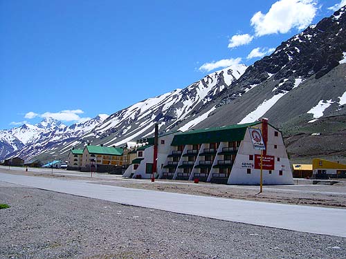
Deserted Penitentes
|
We finally reached Los Penitentes in the early afternoon. Penitentes is about 2,500m above sea level, and it was completely barren but peaceful and deserted at this time of the year. The temperature was about 10deg C in the evening but I was feeling cold, as it was the first time this trip that I had experienced a temperature below 20deg C (Buenos Aries was about 20deg C). But it was an ideal place for acclimatisation.